[EN]
VIROLAHTI – a real-world terrain of south-eastern Finland


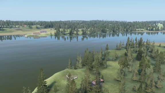
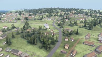
Drive the Valtatie 7 (E18) motorway through farmland, spruce and pine forests and small villages to the Vaalimaa border crossing, or take a boat among the rocky islands of the Gulf of Finland. The landscape is built from open data of the National Land Survey of Finland and made only with Arma Reforger's own assets.


WHAT'S INSIDE
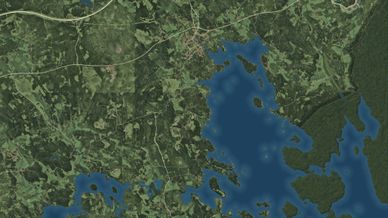
- 18 x 18 km terrain with real elevation (2 m) and a sea floor
- About 1,100 km of roads, from the E18 motorway to forest tracks
- 7,800+ buildings on their real footprints, with churches, hospitals, bus stops and fences
- 12,000 ha of boreal forest (spruce, pine and mixed) on mossy forest floors
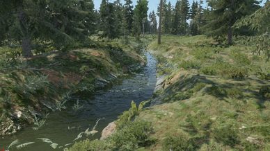
- 11 lakes, wide rivers and about 80 km of streams with real water, beds carved into the terrain
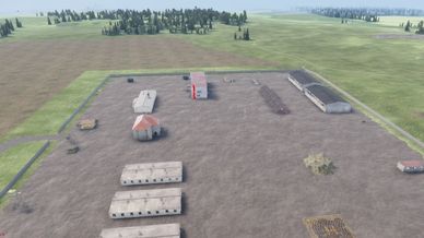
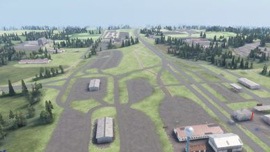
- Industrial sites filled with life: the Vaalimaa Industrial Park by the border, power plants, farms, a sawmill
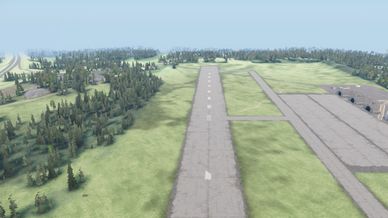
- Fictional military additions: an airfield with a 1,200 m runway north of Virojoki, two fortified garrisons and four outposts
- 190 real place names on the map; towns keep their Finnish names, nature in English style (Lake Häkälä, Vaalimaa River)
- Mod-friendly locations: every town, village, farm, power plant, sawmill, airfield and military base is a vanilla location entity of its type, so scenario and AI mods that look for location types work out of the box
- Real latitude (60.6° N): about 19 hours of daylight in midsummer and 6 hours in midwinter
- AI navigation meshes for infantry and vehicles
- Game Master scenario: "Virolahti - Game Master"


The Russian side of the border is generic forest on real elevation (no detailed data available there).


CREDITS
Inspired by the Arma 3 map "Virolahti - Valtatie 7" by furean (with Tonto and Temppa). No data, models, textures or configs from it were used.
Contains data from the National Land Survey of Finland Elevation model 2 m, Topographic Database (04/2025) and Orthophotos (2021), licensed under CC BY 4.0 (https://creativecommons.org/licenses/by/4.0/). Data was clipped, resampled and classified for game use.
Elevation outside Finland: produced using Copernicus WorldDEM-30 © DLR e.V. 2010-2014 and © Airbus Defence and Space GmbH 2014-2018 provided under COPERNICUS by the European Union and ESA; all rights reserved.
All models and textures are from Arma Reforger, by Bohemia Interactive.


[PT-BR]
VIROLAHTI – terreno real do sudeste da Finlândia


Percorra a autoestrada Valtatie 7 (E18) por campos, florestas de abeto e pinheiro e pequenas vilas até a fronteira em Vaalimaa, ou navegue entre as ilhas de pedra do Golfo da Finlândia. A paisagem foi construída com os dados abertos do National Land Survey of Finland (Maanmittauslaitos) e feita só com assets do próprio Arma Reforger.


O QUE TEM
- Terreno de 18 x 18 km com relevo real (2 m) e fundo do mar
- Cerca de 1 100 km de estradas, da autoestrada E18 às trilhas na floresta
- Mais de 7 800 edificações nas pegadas reais, com igrejas, hospitais, pontos de ônibus e cercas
- 12 000 ha de floresta boreal (abeto, pinheiro e mista) com chão de musgo
- 11 lagos, rios largos e cerca de 80 km de riachos com água de verdade, leitos escavados no terreno
- Áreas industriais com vida: o parque industrial de Vaalimaa junto à fronteira, usinas, fazendas, serraria
- Acréscimos militares fictícios: aeródromo com pista de 1 200 m ao norte de Virojoki, duas guarnições fortificadas e quatro postos
- 190 nomes de lugares reais no mapa; cidades em finlandês, natureza em estilo inglês (Lake Häkälä, Vaalimaa River)
- Locais compatíveis com mods: cada cidade, vila, fazenda, usina, serraria, aeródromo e base militar é uma entidade de local vanilla do seu tipo, então mods de cenário e de IA que procuram tipos de local funcionam direto
- Latitude real (60,6° N): cerca de 19 horas de sol no auge do verão e 6 horas no inverno
- Malhas de navegação da IA para infantaria e veículos
- Cenário Game Master: "Virolahti - Game Master"


O lado russo da fronteira é floresta genérica sobre relevo real (não há dados detalhados lá).


CRÉDITOS
Inspirado no mapa "Virolahti - Valtatie 7" do Arma 3, de furean (com Tonto e Temppa). Nenhum dado, modelo, textura ou config dele foi usado.
Contém dados do Modelo de elevação 2 m, da Topographic Database (04/2025) e das Ortofotos (2021) do National Land Survey of Finland, licença CC BY 4.0. Os dados foram recortados, reamostrados e classificados para uso no jogo.
Relevo fora da Finlândia: produzido com Copernicus WorldDEM-30 © DLR e.V. 2010-2014 e © Airbus Defence and Space GmbH 2014-2018, fornecido pelo COPERNICUS da União Europeia e ESA; todos os direitos reservados.
Todos os modelos e texturas são do Arma Reforger, da Bohemia Interactive.