Summary
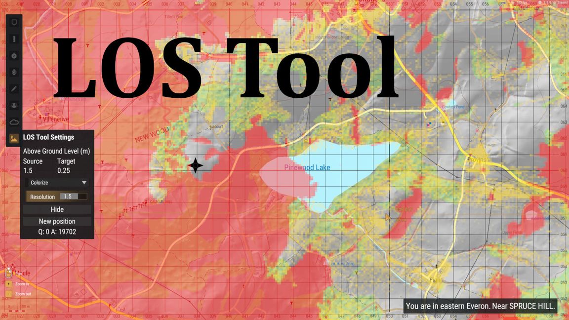
GC LOS is a map tool that lets players examine line of sight from a source point into a target area.
Description
Usage:
1. On your map, activate the LOS tool on the left.
2. Click onto the map to select a source location.
3. Visibility from the source position will be indicated on the map via overlay.

Features:
- Switch between differrent visibility modes: While the default mode only darkens quads according to visibility, the "Colorize" will also differenciate between terrain (red) and object (yellow) occlusion.
- Adjust the source and target height using the UI, they represent altitude above ground. E. g. you could do 1 and 25 to figure out where a low flying helicopter could avoid being seen by an anti aircraft gun.
- Change the resolution multiplier to get a more or less detailed view (relative to zoom level) - high detail might take a while to fully calculate.
License
Arma Public License (APL)