Summary
Updated map with 2.5m contours and adjusted scale bars. Multi-layer LOD for performance.
包含2.5米等高线与调整后比例尺的地图改进。采用多层级LOD以优化性能。
Description
[English]
A map overhaul designed to improve terrain readability and navigation accuracy, following the design style of Realistic Stamina System. This mod adjusts the map’s visual logic and rendering parameters based on topographic standards.
Main Changes:
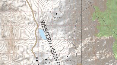
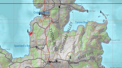
Contour Adjustments: Sets basic contour intervals to 2.5m and major index contours to 10m. This provides a more detailed representation of elevation and landforms.
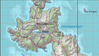
Revised Scale Bars: Modified m_fLegendScaleSize across all zoom levels (200m to 10km) to provide more useful distance references at different scales.
Performance Optimization: Utilizes a 5-layer Level of Detail (LOD) system to manage line density, maintaining stable performance and frame rates in mountainous terrain.
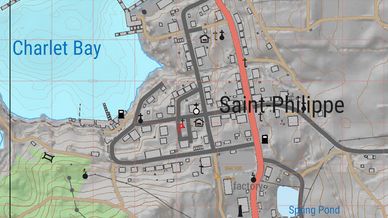
Updated Visual Palette: Replaced default colors with a more neutral scheme, including brown contours, adjusted road colors, and lower-saturation vegetation overlays.
Clarity Improvements: Reduced stroke widths for buildings and grid lines to prevent visual clutter when zoomed in.
[中文]
延续 Realistic Stamina System 的设计风格,本模组旨在提升地图的地形可读性与导航精度。模组对地图引擎的视觉逻辑与渲染参数进行了重新调整。
主要改动:
等高线调整:将基本等高距设为 2.5米,计曲线设为 10米。提供了更详细的海拔与地貌表现。
修订比例尺:修改了所有缩放层级的比例尺分划(200米至10公里),在不同视角下提供更实用的距离参考。
性能优化:采用 5 级细节分级(LOD)系统管理线条密度,确保在复杂山区地形下维持稳定的帧率表现。
视觉配色更新:采用更中性的色彩方案,包括棕色等高线、调整后的道路颜色以及低饱和度的植被图层。
清晰度提升:缩小了建筑与坐标网格的线宽,减少放大时的视觉干扰。
更新日志 (Version 1.0.0)
Initial Release.
Adjusted contour intervals to 2.5m/10m.
Updated legend scale sizes for better distance measurement.
Implemented 5-layer map LOD for performance.
Revised map colors and line widths.
License
Arma Public License (APL)